
Hurricane Florence is still on track for a big impact in the Carolinas, while Maine stays dry and seasonably warm.

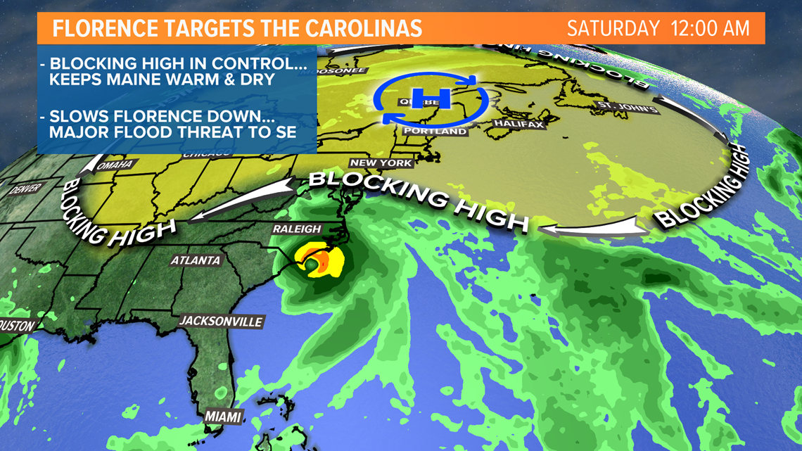
A blocking ridge of high pressure will prevent the storm from coming north. It looks like it will slow down and perhaps even stall near the coast of the Carolinas.
The exact landfall location is uncertain, but the entire coast of South Carolina and North Carolina is at risk.
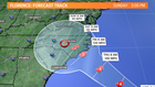

The National Hurricane Center's latest forecast track takes the storm into the coast as a major hurricane early Friday morning. The storm will be slowing in forward speed at that time, and may even stall.
If the center of it stalls over the ocean, it would be able to maintain strength and continue to bring strong wind gusts and storm surge. This would create a worst-case scenario for parts of the coast with life-threatening storm surge.
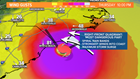
The worst place to be in a hurricane is the right-front quadrant, where onshore winds are strongest and the storm surge is maximized.
Here is an example of how the wind gusts could look as the center of the storm approaches.

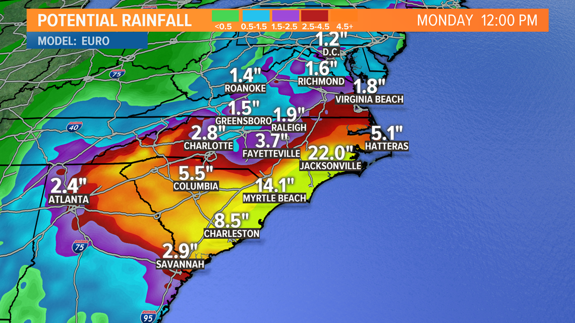
A tropical system hitting the Carolinas typically brings New England remnant rains. Florence probably will not, as it slows, stalls and rains itself out over the southeast.
Catastrophic flash flooding and significant river flooding is possible over portions of the Carolinas and Mid-Atlantic states from late this week into early next week.